In the era of big data, geospatial analysis has become an essential tool for businesses, policymakers, and researchers. The ability to understand and visualize data in relation to geographic space can offer valuable insights and drive informed decisions. One tool that is transforming this landscape is the Distance Matrix API.
This article explores the role of the Distance Matrix API in geospatial analysis, its application in visualizing data with maps, enabling clustering analysis for locations, and real-world examples of geospatial analysis.
Geospatial Datasets and Their Uses

Geospatial datasets are a collection of geographic data or information associated with a specific location. These datasets are used in various fields such as urban planning, logistics, environmental management, and public health, among others. They are typically composed of two types of data: spatial data (e.g., coordinates, topology, and size) and attribute data (e.g., demographic information, land use, and climate).
The usage of geospatial datasets transcends multiple sectors. In logistics, for instance, these datasets are used to optimize routes, minimize fuel consumption, and reduce delivery times. In urban planning, geospatial data helps identify the best areas for development or conservation based on various criteria like population density, land use, and proximity to amenities. Environmental scientists use this data to monitor changes in ecosystems, track wildlife migration, and predict the impact of climate change.
The Distance Matrix API plays a crucial role in leveraging geospatial datasets. As a distance api, it calculates the distance and travel time between multiple locations, enabling users to analyze geographic relationships at a granular level. The API can process large volumes of data quickly and accurately, making it a powerful tool for geospatial analysis.
Visualizing Data with Maps
Maps are a universal tool for visualizing geospatial data. They allow us to understand complex geographical patterns and relationships in a straightforward, visual manner. By using maps, data can be presented in a way that is easy to comprehend, helping to drive data-informed decisions and strategies.
The Distance Matrix API significantly enhances the process of visualizing data with maps. The API takes the data from geospatial datasets and translates it into a form that can be easily plotted on a map. By doing so, it enables users to visualize complex data relationships in a meaningful, spatial context.
The API also supports different types of visualizations, from simple point-to-point distances to more complex heat maps and choropleth maps. These visualizations can provide a wealth of insights, such as identifying areas of high population density, visualizing traffic patterns, or pinpointing optimal routes for logistics operations.
Clustering Analysis for Locations

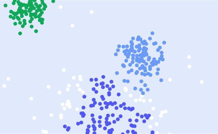
Clustering analysis is a technique used to group similar entities based on certain criteria. In the context of geospatial analysis, clustering can be used to identify areas with similar characteristics, such as demographic features, land use patterns, or economic activity. This information can be incredibly valuable for businesses, policymakers, and researchers.
With the Distance Matrix API, clustering analysis becomes much more accessible and efficient. The API can calculate the distance between any number of points, enabling users to group locations based on their proximity to each other or other key parameters. This capability can support various applications, from identifying property hotspots for real estate developers to clustering retail outlets for efficient supply chain management.
In addition, clustering analysis with the Distance Matrix API can also help in identifying anomalies or outliers. For instance, it can detect areas that are disproportionately affected by a particular issue or event, allowing stakeholders to take targeted actions.
Real-World Examples of Geospatial Analysis
There are countless real-world examples of geospatial analysis powered by the Distance Matrix API. Here are a few that demonstrate its versatility and impact.
In the logistics industry, companies use the Distance Matrix API to optimize their delivery routes. By calculating the quickest routes between multiple locations, the API helps these companies reduce fuel consumption, save time, and boost customer satisfaction.
Urban planners and architects leverage the API to guide their work. By visualizing data such as population density, land use, and transportation networks, they can make informed decisions about where to build new infrastructure or how to redesign existing spaces.
Meanwhile, in the environmental sector, the Distance Matrix API is used to monitor and manage natural resources. For example, it can help track the movement of wildlife or measure the impact of climate change on specific locations.
Incorporating the Distance Matrix API into Applications

The Distance Matrix API is a remarkable tool for developers aiming to seamlessly integrate geospatial data into their applications. At its core, it provides the distance and duration for pairs of locations, a service that becomes pivotal for numerous applications, especially those relying on route optimization or real-time location tracking. The integration of such an API can transform the usability of a platform by enhancing its relevance and accuracy. Imagine a delivery service application that can dynamically calculate the most efficient routes based on real-time traffic or an event planning tool that can suggest venues based on attendees’ proximity.
Furthermore, by combining the API’s data with other geospatial tools, developers can create detailed heat maps, proximity analyses, or even forecast future traffic patterns. In a world where efficiency and timely decision-making are paramount, embedding the Distance Matrix API ensures that applications remain a step ahead, leveraging spatial data to offer solutions that were once considered complex and time-consuming. As urban areas become more congested and businesses aim to optimize resources, tools like the Distance Matrix API will undoubtedly become foundational in application development.
Final Summation
The Distance Matrix API is a powerful tool for geospatial analysis. By enabling users to leverage geospatial datasets, visualize data with maps, and perform clustering analysis for locations, it provides valuable insights that can drive informed decisions and strategies. Whether you’re a business owner, a policymaker, or a researcher, the Distance Matrix API can enhance your work and help you make the most of your data. Embracing such technology is not just a leap toward modernization but a stride toward harnessing the true potential of spatial data. It’s not just about distance; it’s about deriving meaningful connections.


